The official website of Visit Causeway Coast and Glens
En

Layd Church

Shore Road, Cushendall, County Antrim, BT44 0NG
Product Image
  • Product Image
  • Product Image
  • Product Image
  • Product Image

Book Tickets Online

About

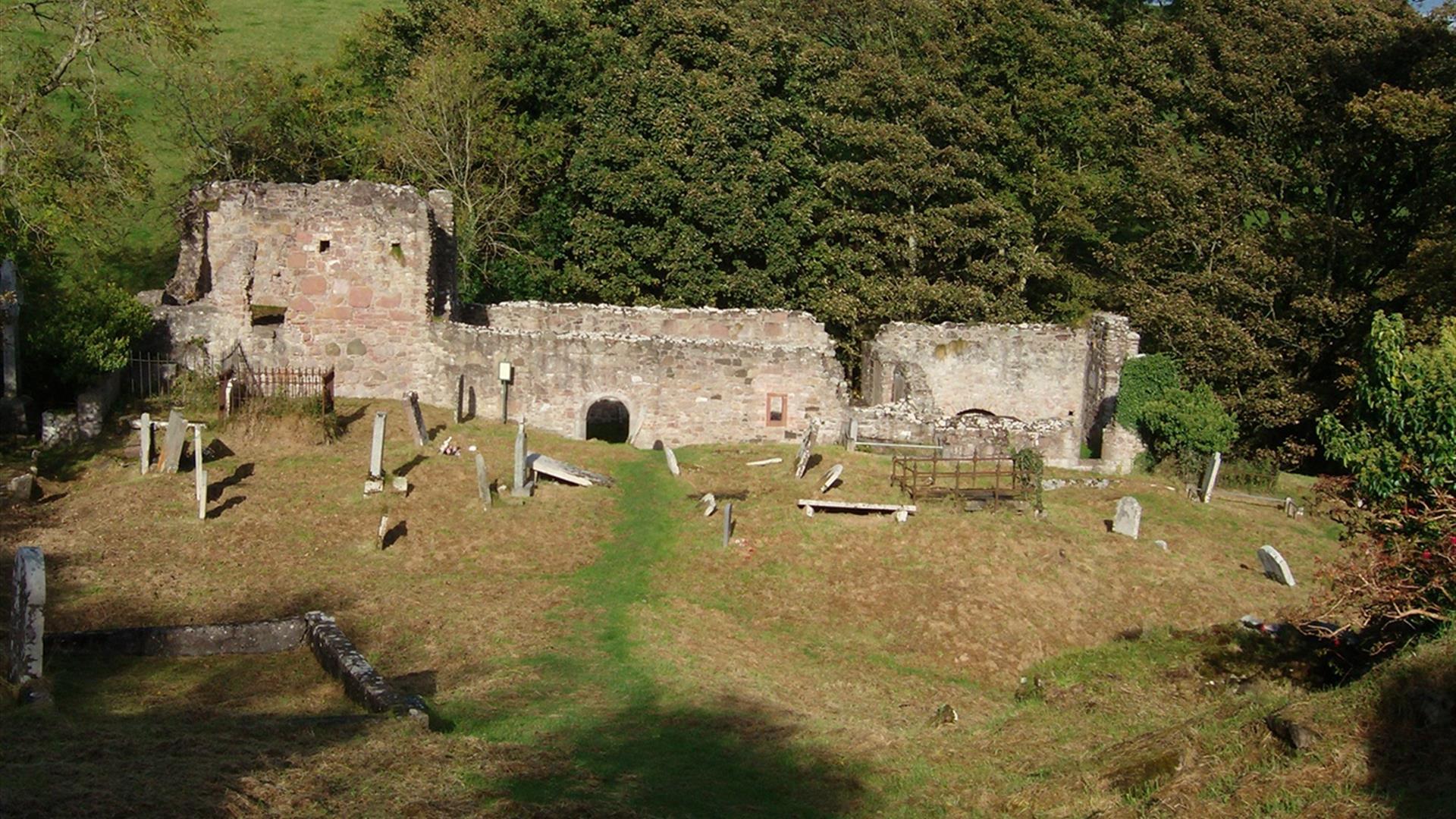
The walk is a coastal cliff path walk beginning at Shore Street, Cushendall at the entrance to the golf club and following the laneway northwards for approximately 200m before turning right onto the cliff path. Continue along the cliff path passing Salmon Rock and Port Vinegar taking you to the ruins of Layd Church a a 13th century Franciscan foundation. Chief burial place of the MacDonnell's after Bonamargy which has been built at least three times and served as a parish church from 1306 to the end of the 18th century. Fine stones in the graveyard include a cross in memory of Doctor James MacDonnell, pioneer in the use of chloroform for surgical operations. Open access all year round.

A 13th century Franciscan foundation. Chief burial place of the MacDonnell's after Bonamargy which has been built at least three times and served as a parish church from 1306 to the end of the 18th century. Fine stones in the graveyard include a cross in memory of Doctor James MacDonnell, pioneer in the use of chloroform for surgical operations. Open access all year round.

Please note: Following an inspection, the Cushendall Cliff Path has been closed until repair works can be carried out to the wooden decking structures. The Council will look at carrying out this work in the New Year.

Start Point:
D245289

Finish Point:
D245289

Route:
In the Village of Cushendall take the Shore Road and park in the layby (toilets are located at the layby). Follow the laneway northwards for approx. 200m, turn right onto the cliff path and follow the path along the coast to Layd Church.

Distance:
0.5 miles

Terrain:
Hard core and grass path

Point of interest:
Layd Church, coastal views

Facilities:
Toilet and car parking facilities are available at the layby at the start of the walk. There are a number of restaurants, bars, cafes and shops situated in the village of Cushendall.

Publication:
None

Nearest town:
Cushendall

OS map:
Sheet 5

Accessible terrain:
Unsurfaced track, fairly steep

Facilities

Provider Preferences

  • Free (parking charges may apply)

Map & Directions

What's Nearby

  1. Located one mile from Cushendall are the delightful ruins of a 13th century Franciscan…

    0.56 miles away
  2. A 13th century hilltop castle with a couple of names, a commanding view – and a…

    0.86 miles away
  3. The ruins of Ardclinis Church and Graveyard occupy a beautiful setting overlooking Red…

    2.68 miles away
  1. The beautifully restored Old Church Centre offers arts & heritage events, exhibitions,…

    2.97 miles away
  2. Glenariff, the Queen of the Glens, is one of the nine Antrim Glens in Northern Ireland.…

    5.17 miles away
  3. A lonely and mysterious Moorland Lake, sometimes called the 'Vanishing Lake'.

    5.41 miles away
  4. Five-mile drive through peatland forest with many fine views of Rathlin Island and…

    6.25 miles away
  5. Located within the Slieveanorra and Croaghan Area of Special Scientific Interest (ASSI),…

    7.39 miles away
  6. A traditional Irish sheep farm experience in County Antrim. Get an insight into sheepdog…

    7.69 miles away
  7. Nestled within the famous Glens of Antrim you can expect a warm welcome at Dunfin, a…

    7.69 miles away
  8. Breen Oakwood is part of the larger Breen Forest and is one of the last fragments of the…

    8.93 miles away
  9. There are two way-marked hill walks at Altarichard on the scenic route between…

    9.43 miles away
  10. The Causeway Coast Discovery Centre is a 2014 and 2015 Tourism Award-winning centre. A…

    10.24 miles away
  11. The Mc Donnell Trail Centre will help you understand some of the history of the castles,…

    10.24 miles away
  12. Remains of Franciscan friary founded around 1500 by Rory MacQuillan. East range of…

    10.64 miles away
  13. Ballycastle Beach offers stunning views of Rathlin Island and Fairhead and is…

    10.64 miles away
Previous Next

Map & Directions

Road Directions

From Cushendall, take the coastal road to Cushendun. Car park is 1.6km along this road.

Public Transport Directions

Translink - journeyplanner.translink.co.uk

View Maps and Visitor Guides
View of what Causeway Coast and Glens has to offer and some of the best things to see and do during a visit.
E-newsletter sign up
Sign up for the Causeway Coastal Route newsletter for inspiration and travel tips.
Back to Top

Tourism Northern Ireland

Don't Miss