The official website of Visit Causeway Coast and Glens
En

Binevenagh Forest

Limavady, Co Londonderry
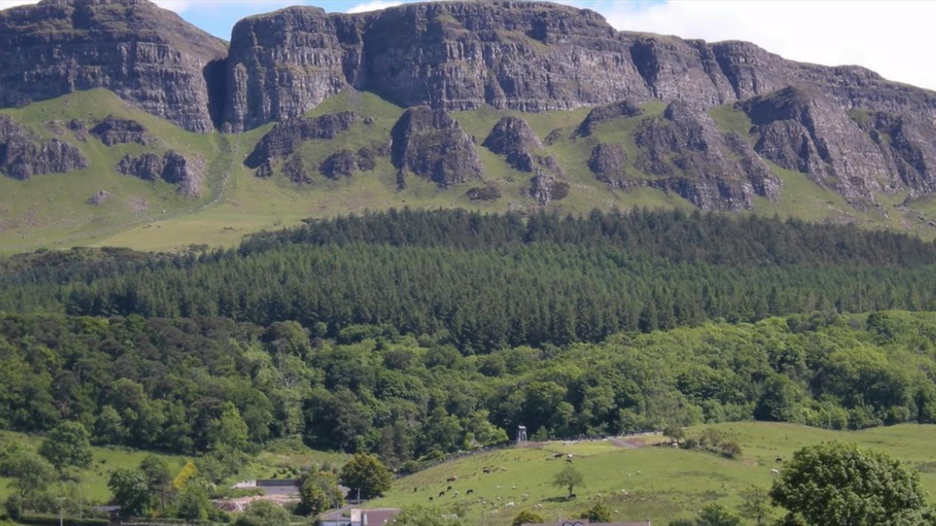
view of Binevenagh Mountain
  • view of Binevenagh Mountain
  • view over Lough Foyle and Donegal from Binevenagh at sunset. There is a herd of sheep in a field.

Book Tickets Online

About

Binevenagh is renowned for its impressive cliffs that provide a perfect alpine cliff ledge for many rare plants and mosses. It is home also to a standing stone that has become known as the Finn MacCool Finger Stone, relating to the famous giant reputed to have lived in the area many years ago.

Take the A2 coast road out of Limavady and keep on the road as it changes to the B201 road to Coleraine. After a mile, take left fork onto the Bishops Road and follow the signs for Binevenagh.
 

Add Binevenagh Forest to your Itinerary

Close window

Call direct on:

Tel+44 (0) 28 2955 6000

Map & Directions

What's Nearby

  1. Gortmore's superb Viewpoint situated on the Bishop's Road on the Binevenagh Loop, as part…

    1.21 miles away
  2. Downhill is a golden sandy beach stretching from Downhill Cliffs in the east towards…

    2.07 miles away
  3. Benone Strand, multiple recipient of the European Blue Flag and Seaside Award, is a…

    2.1 miles away
  1. Hezlett’s picturesque thatched cottage exterior hides a fascinating early timber frame…

    2.17 miles away
  2. Mussenden Temple is located in the beautiful surroundings of Downhill Demesne near…

    2.17 miles away
  3. A picture-perfect seaside village in Binevenagh Area of Outstanding Natural Beauty.

    2.72 miles away
  4. Castlerock is a 1km (0.7 mile) long stretch of beach between the sea cliffs of Downhill…

    3.08 miles away
  5. Binevenagh is a tranquil area where the sights of Lough Foyle and Donegal can be seen on…

    3.27 miles away
  6. An inscribed stone cross at Duncrun marks the site of St Patrick's Monastery and the…

    3.68 miles away
  7. Picturesque riverbank area overlooking the River Roe beneath Binevenagh Mountain – a…

    4.47 miles away
  8. Between Portstewart and the mouth of the River Bann lies the golden sands and domineering…

    5.17 miles away
  9. A well preserved Martello Tower at Magilligan Point, an important historical site in…

    5.68 miles away
  10. Magilligan Point is the tip of one of the largest sand dune systems in the British Isles.…

    5.69 miles away
  11. Flowerfield Arts Centre is Coleraine’s dedicated arts facility, offering superb…

    5.94 miles away
  12. Situated on either side of River Bann. Mixed woodland planted 19th Century and the 1930s…

    6.96 miles away
  13. Coleraine Town Hall presides over the central shopping piazza in Coleraine. Designed by…

    7.07 miles away
Previous Next

Map & Directions

Road Directions

Directions from Town:Off the A2, 5 miles N of Limavady

View Maps and Visitor Guides
View of what Causeway Coast and Glens has to offer and some of the best things to see and do during a visit.
E-newsletter sign up
Sign up for the Causeway Coastal Route newsletter for inspiration and travel tips.
Back to Top

Tourism Northern Ireland

Don't Miss